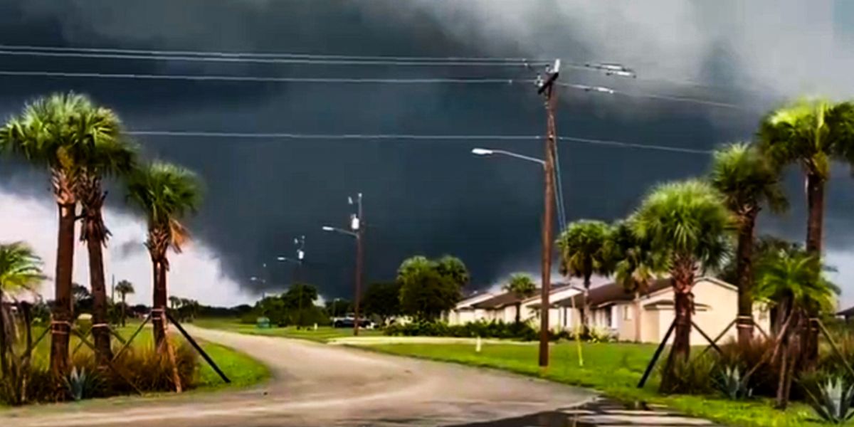
Tornadoes have been spotted in parts of South Florida as Hurricane Milton draws closer, prompting authorities to urge residents to safety.
As of Wednesday morning, October 9, 2024, multiple tornadoes were reported across South Florida. The local National Weather Service (NWS Miami) issued urgent warnings as more severe weather, fueled by the approach of Hurricane Milton, swept across several counties.
Tornadoes have been confirmed in areas including the Everglades, Big Cypress Seminole Indian Reservation, and locations near major highways. South Floridians should stay alert as more tornadoes remain possible
At 10:08 a.m., NWS Miami-South Florida posted a message on their X (formerly Twitter) account, “TORNADO crossing I-75 as we speak! Seek shelter NOW!”
Another post followed, warning of a tornado on the ground over the Big Cypress Seminole Indian Reservation, urging people in the vicinity to take shelter. The NWS retweeted images of the tornados life cycle. By 10:21 a.m., another sighting was posted, showing west-northwest of the Miccosukee Service Plaza.
Users responded to these messages with pictures and videos of their own. “Outside Weston. Just took this,” a resident posted at 10:26 a.m. Another netizen from the area added a picture and wrote, “From my window in Weston…”
Other outlets have posted footage of the natural phenomena as well. One clip shared on WPLG Local 10s YouTube channel captures a tornado passing through west Pembroke Pines.
In another video, a tornado is seen moving through the Everglades, near Alligator Alley, with dark clouds swirling overhead. Another striking clip comes from Southwest Ranches, where a tornado was caught on cellphone video.
At 10:56 a.m., the NWS issued a reminder, stressing that multiple tornadoes had already been confirmed and that three active warnings were in effect. “Additional tornadoes remain possible,” they warned, as Hurricane Milton gets closer to landing.
At 11:46 a.m., the NWS posted another urgent update, “Reports of another meso-vortex Tornado ongoing on the western side of Lake Okeechobee near Lakeport. 4 Ongoing Tornado Warnings – Naples Metro, Pahokee/Canal Point, Lakeport, Ortona. SEEK SHELTER NOW!”
At 12:41 p.m., the NWS posted another alarming update, “🚨 Storm Surge Threat Beginning🚨 Views from the Naples Pier this afternoon indicate that #Miltons surge is beginning to arrive across coastal southwestern Florida with water levels steadily rising during what should be low tide Stay alert!”
Later in the afternoon, at 1:30 p.m., they provided a radar update, “A large convective band of Hurricane #Milton continues to rotate across southwestern Florida. A new Tornado Warning is in effect 1:45 p.m. for Collier and Hendry counties.”
By 1:37 p.m., a storm surge warning remained in effect for coastal Collier and Mainland Monroe counties. The NWS indicated that winds were shifting to a more southerly onshore direction, likely increasing the surge, with estimates of 3–8 feet of storm surge possible in affected areas.
At 2 p.m., they confirmed Hurricane Miltons sustained winds had reached 130 mph, with tornado warnings and storm surge threats continuing across southwestern Florida.
The danger escalated further by 2:40 p.m. as the NWS reported that the large convective band of Hurricane Milton continued rotating through South Florida. “We have 4 active Tornado Warnings ongoing,” they posted. “We have issued 39 Tornado Warnings today as of 2:45 p.m.” This tally underscored the relentless severity of the storm.
At 3 p.m., the NWS provided an overview of all tornado warnings issued by NWS offices in Tampa Bay, Miami, and Melbourne. As of that time, 53 total tornado warnings had been issued throughout the day, 41 of them by NWS Miami alone. “Please remain aware for current and future tornado warnings!” the agency emphasized.
Just minutes later, at 3:05 p.m., reports of structural damage in Lakeport, FL, emerged as the most recent tornado-warned storm moved through. This marked the seventh confirmed tornado of the day, and the second to hit Lakeport.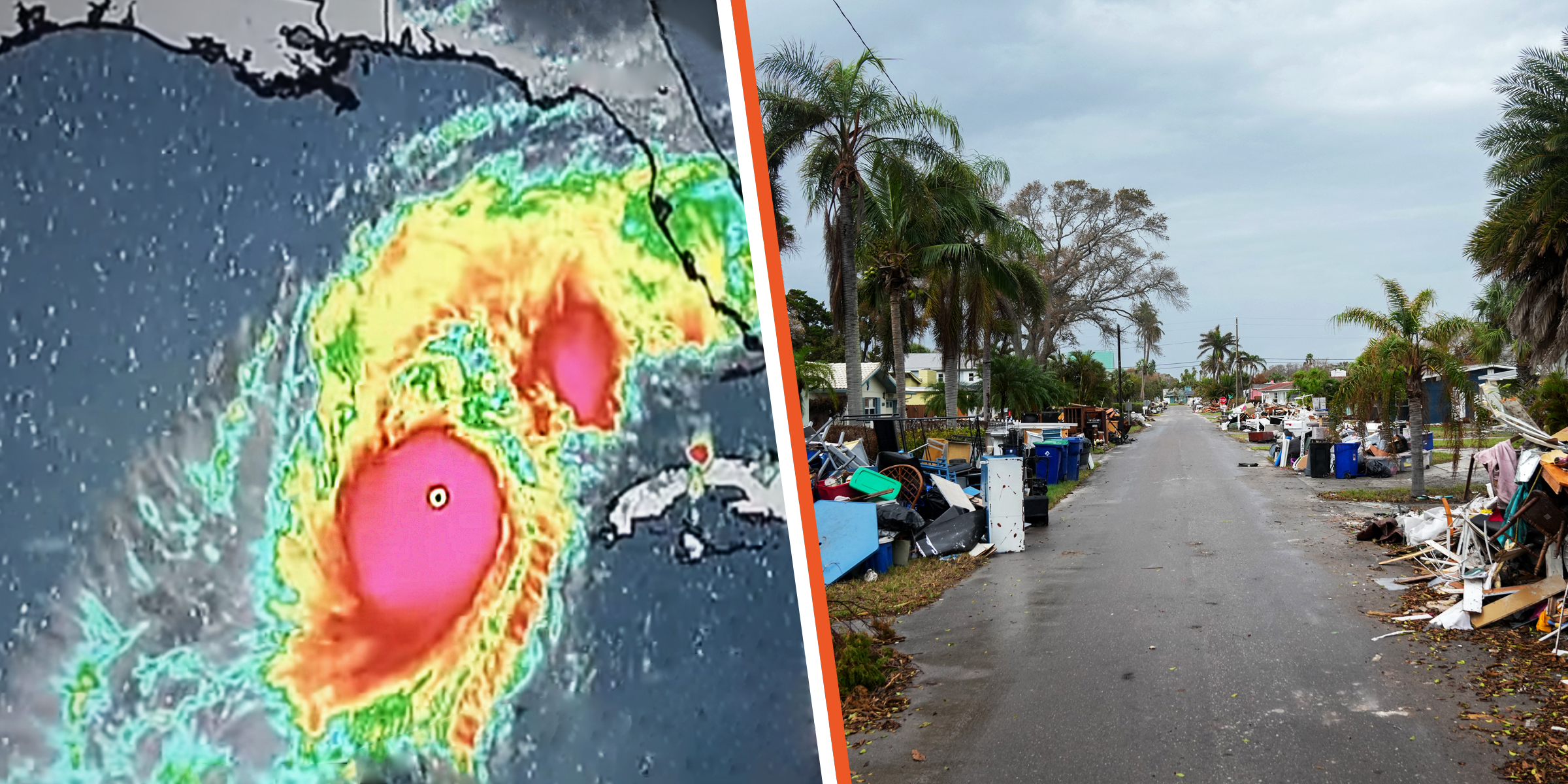 Hurricane Milton: A Simulation Illustrating the Potential Catastrophic Impact and Expected Locations in the Coming Hours
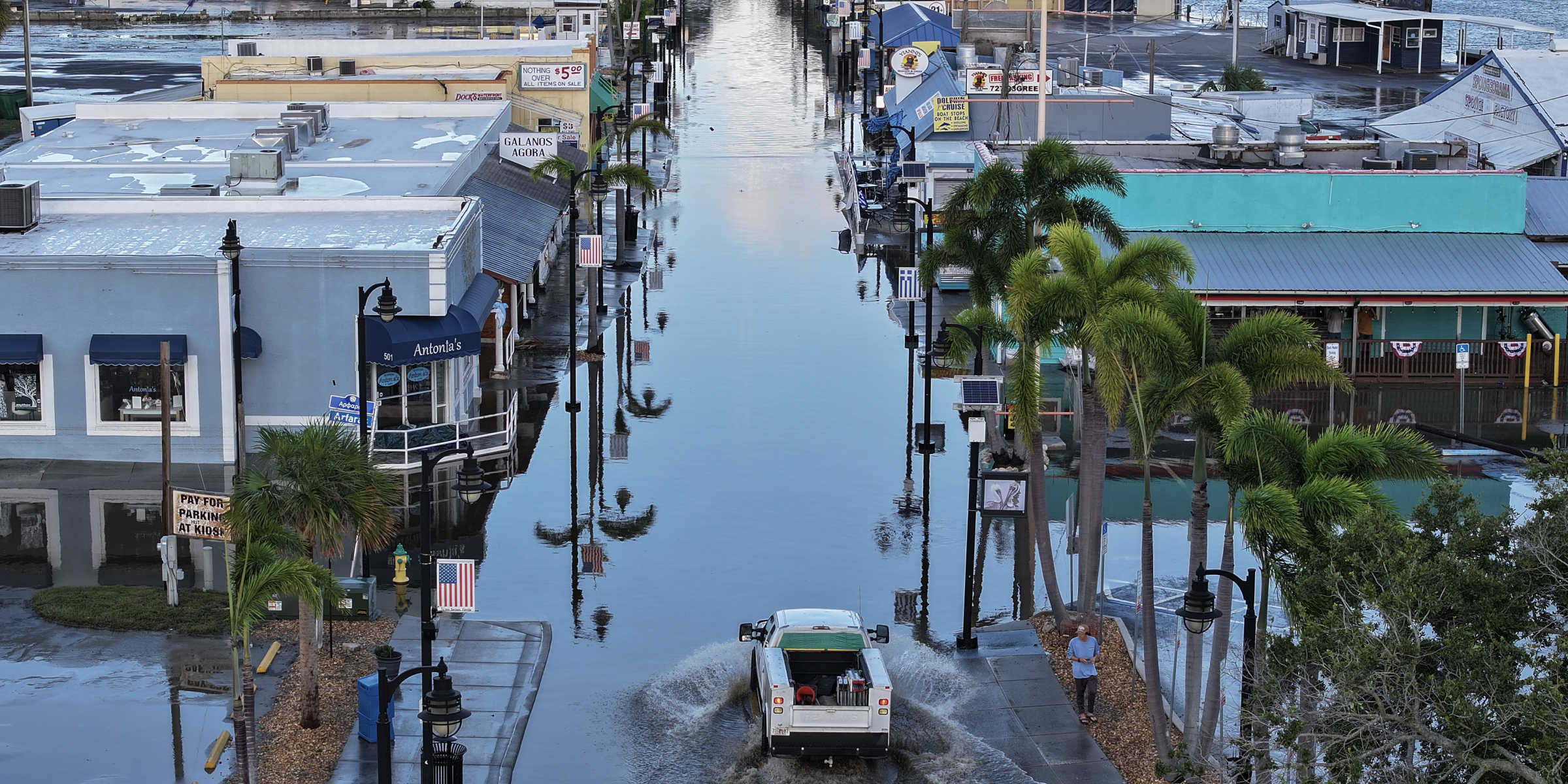 What to Know about Hurricane Milton: Timeline, Affected Areas & More
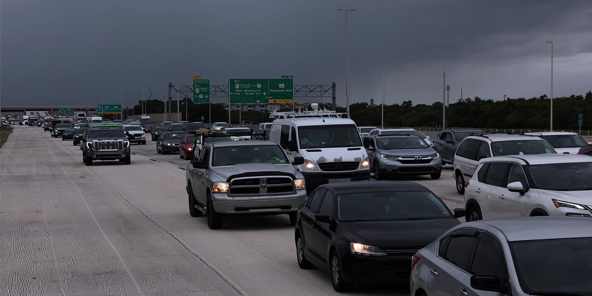 Hurricane Milton Could Be the Worst US Storm to Hit the Area in 100 Years: Evacuation Zones MappedAdvertisement
By 3:46 p.m., the NWS clarified expected storm surges, warning of 5–8 feet from Bonita Beach to Chokoloskee, and 3–5 feet from Chokoloskee to Flamingo.
As the storm progressed, the situation continued to worsen, with reports of street flooding arriving by 4:20 p.m. in southwestern coastal communities. The NWS warned, “Given #Miltons fast forward speed, the increase in water levels may be sudden. DO NOT DRIVE THROUGH SALTWATER!”
Residents are urged to continue monitoring the latest updates from trusted sources and seek safety immediately. Stay informed, stay safe, and take the necessary precautions to protect yourself and your family during this extreme weather event.